

Publications

Latest bulletins & reports

One searchable library — every forecast, advisory and report in a single filterable place.

Browse the library →
River breakages

Status of River Breakages Along the Shabelle River - Issued Aug 20 2026

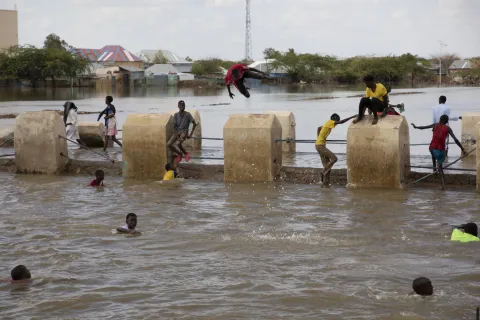
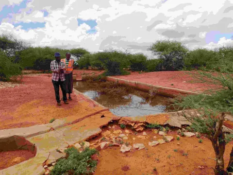
The Food and Agriculture Organization's Somalia Water and Land Information Management (FAO SWALIM) Project has completed the analysis and mapping of river breakages along the Shabelle River using very high resolution (VHR) satellite imagery, as of August 2026. Breakages identified in the map have been classified into four categories: River Overflow, Open, Canal Flooding, and Closed with Sandbags. A legend/key for further explanation of the different breakage types is provided. Along the Shabelle River, a total of 388 breakage points have been identified, comprising 150 River Overflow points, 147 Open points, 66 Canal Flooding points, and 25 points Closed with Sandbags. Sites with current, cloud-free VHR imagery available at the time of analysis were newly verified; sites lacking current imagery coverage or affected by cloud cover retain their most recently verified status from prior assessments. Heavy concentrations of open breakages and overflow points are observed along key agricultural districts including Beletweyne, Buloburde, Jowhar, and Balcad, extending south to Kurtunwarey and Sablaale. There is a need to close the open points and reinforce areas with weak river embankments to avoid loss of lives and livelihoods during the upcoming rainy season. Breakage analysis for the Juba River has not yet been released due to budgetary constraints; updates will follow as resources and satellite imagery become available.

PDF ·20 Aug 2026 ·7.64 MB

Download

Newsletter

SWALIM 2026 Quarter 2 Newsletter

The SWALIM Quarterly Newsletter – April–June 2026 highlights key activities, achievements and knowledge products delivered by FAO SWALIM during the second quarter of 2026. The issue covers Gu 2026 climate and drought monitoring, flood preparedness, the 2026 Riverine Area Land Cover Map covering 10.4 million hectares, drone-based watershed assessments in Puntland, nationwide Prosopis field data collection, and SWALIM’s water, land and climate information platforms. The newsletter showcases how SWALIM’s data, analysis and information services are supporting evidence-based decision-making, climate resilience, water management, food security and sustainable land management across Somalia.

PDF ·16 Aug 2026 ·2.46 MB

Download

Ground water

Groundwater Monitoring Update June 2026

The Somalia Groundwater Status Update, issued on 30 July 2026 by Somali Water and Land Information Management (SWALIM), presents the latest assessment of groundwater conditions across Somalia based on weekly monitoring of strategic boreholes and data from telemetric groundwater monitoring stations. In June 2026, 608 strategic boreholes were monitored, of which 578 were functioning and 30 were non-functioning, resulting in an overall functionality rate of approximately 95%. Pump failure was the leading cause of borehole malfunction, accounting for 50% of reported failures, followed by power supply and main rising pipe issues. The bulletin also examines borehole usage, water prices, groundwater-level trends, and electrical conductivity across different regions. The bulletin reviews the implications of the 2026 Gu rainfall season for groundwater recharge, highlighting significant rainfall deficits in northern Somalia and comparatively near-normal rainfall in much of south-central Somalia. It also provides a groundwater outlook for the Hagaa/Karan season (July–September 2026), when increased reliance on groundwater is expected as surface-water availability declines. The update concludes with priority actions focused on maintaining and rehabilitating strategic boreholes, restoring non-operational telemetric stations, strengthening groundwater-level and water-quality monitoring, and integrating groundwater information with seasonal climate forecasting and drought early-warning systems. These measures are intended to support proactive, climate-resilient groundwater management and timely humanitarian and development interventions.

PDF ·16 Jul 2026 ·1.4 MB

Download